Best iPhone map apps
Five alternatives for those times when Apple Maps service is sending you into a river rather than your gran’s house

Apple Maps is currently a bit of a mess, plagued by iffy info, patchy picture quality and rotten routing. Yes, it’ll probably be improved in the not too distant future – but that doesn’t help you if you’re using iOS 6 and need to find something or get somewhere right now. Here are five of the best mapping apps for iPhone.
Or if you simply can’t do without Google Maps, here’s our guide to getting it back on your iPhone.
Note: all of these apps except Bing are designed for both iPhone and iPad. Bing will run on the iPad, of course – but will simply be the iPhone version blown up in size.

Free, App Store
We wouldn’t say the Bing app’s mapping subsection is blow-your-socks-off amazing – it can be sluggish and some of the public transport routing is a bit off – but it’s certainly better than Apple’s own offering at the moment. The street and satellite views are clear and directions are generally reliable.
Bing

Free, App Store
Waze, or “Waze social GPS traffic and gas”, to use its full name, takes the crowd-sourcing concept to navigation. Everybody that uses the app (Waze claims “the community” is 30 million strong) contributes to its accuracy and usefulness. Not that you actually have to do anything other than drive around with the app open to do so, as some info is passively contributed automatically. Those who want to take a more active role can share reports on accidents. Given that it’s gratis, Waze is a great navigation app.

Free, App Store
Navfree is pitched as a proper satnav app that costs nothing. So what’s the catch? Well, the maps can be a tad sketchy at times, particularly in suburban areas (although user feedback means they’re improving all the time), the voice navigation comes across as slightly reticent and some features, like speed cameras, are only available as in-app purchases. But for free? It’s pretty good.
Waze

£49.99, App Store
Yes, we know dropping fifty sheets on an app hurts bad, but for our money TomTom comes closest to replicating a standalone satnav system for a smartphone. You don’t need a mobile signal to use it (all the maps are stored on your iPhone or iPad) and features like speed camera locations, HD Traffic and IQ Routes make this a truly comprehensive system.

Free, App Store
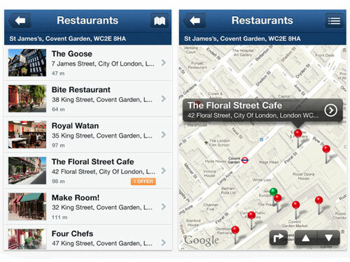
If you’re more interested in finding local services like pubs, petrol stations and supermarkets than navigation, NearMe does the job like a champ. It works worldwide, uses Google Maps to direct you to a location and hands you contact details for making reservations as well as special deals. Note: if you’re in the US, try the Yelp! app, which is a million times more useful there than it is in Blighty.
How to get Google Maps back on your iPhone
Should you upgrade your iPhone to iOS 6?
Stuff Office Cat’s Diary – 25/09/12
Navfree GPS Live


TomTom UK & Ireland


NearMe


